
Acting from a distance: GeoVisor an app for safe places and not just an app against COVID-19
DOI:
https://doi.org/10.15381/espiral.v2i4.19537Keywords:
GeoVisor, Jequetepeque, Pandemic, Neogeo - graphiesAbstract
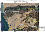
This work aims to publicize the GeoVisor Application proposal, placing us in the context of a pandemic and the common Neogeographies practiced by the Jequetepeque population. GeoVisor is intended to be an app against the COVID - 19 and for the geolocation of safe places, but acting from a distance and taking into account the ethnographic nature of the population. A collaborative project of professionals in geotechnologies facing the world scenario of the COVID-19 and within the Peruvian context, having as a study area the District of Jequetepeque in the department of La Libertad.
Downloads
Published
Issue
Section
License
Copyright (c) 2021 Juan Manuel Delgado Estrada, Carlos Bryan Becerra Blaz, Mario Rafael Olivas Villanera, Víctor Alexis Bartolomé Liendo Huasco

This work is licensed under a Creative Commons Attribution-NonCommercial-ShareAlike 4.0 International License.
LOS AUTORES RETIENEN SUS DERECHOS:
a. Los autores retienen sus derechos de marca y patente, y también sobre cualquier proceso o procedimiento descrito en el artículo.
b. Los autores retienen el derecho de compartir, copiar, distribuir, ejecutar y comunicar públicamente el artículo publicado en la revista Espiral (por ejemplo, colocarlo en un repositorio institucional o publicarlo en un libro), con un reconocimiento de su publicación inicial en la revista Espiral.
c. Los autores retienen el derecho a hacer una posterior publicación de su trabajo, de utilizar el artículo o cualquier parte de aquel (por ejemplo: una compilación de sus trabajos, notas para conferencias, tesis, o para un libro), siempre que indiquen la fuente de publicación (autores del trabajo, revista, volumen, número y fecha).


