Social and environmental assessment developed in the Apurimac region mining exploration, project Los Chancas (Antilla and Molle Green)
DOI:
https://doi.org/10.15381/iigeo.v16i31.11289Keywords:
Environmental Impact Investment Projects, Environmental Impact StudyAbstract
Peru is a country traditionally mining, however, this activity causes and/or generates a series of positive and negative impacts on the environmental areas where develops. Methodologies for the assessment of environmental impacts are diverse.
The mining project the Chancas is located in the Department of Apurimac in the province of Aymaraes, and is between the altitudes of 2800 and 4075 m.a.s.l. , 98 km from the city of Abancay. It is precisely in the eastern flank of the Western Cordillera of the Andes, in the slopes of the right margin of the basin of the rio Antabamba.
The main path of the project evaluation is by the road, leaving the city of Cuzco, which is directed to Chalhuanca, taking a detour from Santa Rosa through the Antabamba river basin, passing through Abancay.
The area is characterized by wild being, very steep, with vegetation mostly grass with few trees, due to the limitation of the altitude. The project is located in the micro-watershed of Pacchantay, tributaries of the Antabamba. In the absence of information rainfall, we used the model of the method of Davies that calculation in the micro-watershed in reference an average that could have flow rates from 0.01 to 0.163 m3/s.
The analysis of surface water, were conducted at the Institute of corrosion and Protection of the Pontificia Universidad Católica del Perú. The results physical-chemical whose waters reflect the optimum quality of the area.
The evaluation of the quality of the soil of the project is development of shallow, because they are in areas of steep slopes very susceptible to erosion. In general, the soils are clayey to francs with high rate of stoniness.
The flora and fauna of the place is not endangered or threatened species. The quality of the soil is a strong determinant of the associations of plants, showing a limited presence of tree species due to this reason and the altitude. The fauna is estimated mainly comprised of smaller animals.
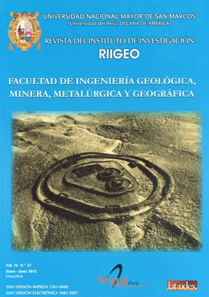
Within the area of exploration of the project the Chancas were identified an archaeological zone, called Muyu Muyu Ruins.
The archaeological site is associated with a set of platforms that corresponds to the people of Tapayrihua.
The scope of work are variable, with an area of disturbance that is 2.65 to 10.5 hectares. The perforations diamantinas will cover an area of 19 to 30 hectares. The expected impact of these activities will be confined to possible increases in erosion in areas with steep slopes. The proposed actions for its prevention, mitigation and control are specified in accordance with the guidelines of the Environmental Guide to the activities of exploration for mineral deposits issued by the Ministry of Energy and Mines. In addition, measures must be taken to prevent the runoff of water increase the erosional process in hillsides steep slopes. Liquid and solid waste will be handled in such a way that does not pose risks environmental or health during and after the campaign of mineral exploration. Finally, we maintain a program of monitoring surface water to control the quality of these.
Downloads
Published
Issue
Section
License
Copyright (c) 2013 Teófilo Miguel Concha Contreras

This work is licensed under a Creative Commons Attribution-NonCommercial-ShareAlike 4.0 International License.
AUTHORS RETAIN THEIR RIGHTS:
a. Authors retain their trade mark rights and patent, and also on any process or procedure described in the article.
b. Authors retain their right to share, copy, distribute, perform and publicly communicate their article (eg, to place their article in an institutional repository or publish it in a book), with an acknowledgment of its initial publication in the Rev. Inst. investig. Fac. minas metal cienc. geogr.
c. Authors retain theirs right to make a subsequent publication of their work, to use the article or any part thereof (eg a compilation of his papers, lecture notes, thesis, or a book), always indicating the source of publication (the originator of the work, journal, volume, number and date).


