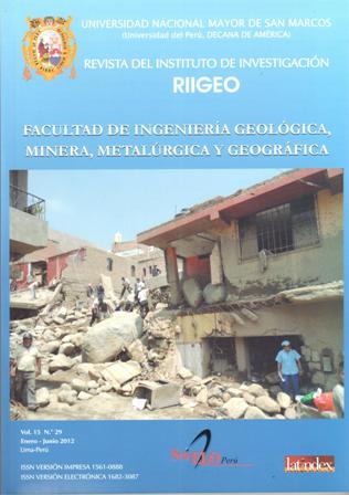
Characterization and analysis of landslides of April 5, 2012 Chosica-Lima
DOI:
https://doi.org/10.15381/iigeo.v15i29.2206Keywords:
Chosica landslides, Natural Disasters, Rimac RiverAbstract
Flows of mud and mud known as the Peruvian coast landslides are recurring geological phenomena, especially in the area of Chosica. The formation of the avalanche starts with the physical, chemical and biological weathering, next to fracturing and faulting of rocks of the Batholith Andino, where for long periods rocks deteriorate exfoliating, disintegrating, also forming rocks spheroidal disjunction, ie, large diameter rocks subrounded to subangulosas, reaching sizes of sand and clay. Subsequently, from this, for erosion and transport due to intense and short rains in the basin, make mud flows called landslides that descend impetuously both major streams, secondary and side gullies to form the mainstem, and such as competence and geodynamic behavior, either by erosion or deposition (burial) destroy the various buildings and services for the people. Finally, characterized and analyzed most of the landslides occurred on the left bank of the Rimac river, formed by the streams Cantuta, Santo Domingo, Mariscal Castilla, La Ronda, California and landslides occurred on the right bank, formed by the streams Quirio, Pedregal Freedom Carossio and Corrales.
Downloads
Published
Issue
Section
License
Copyright (c) 2012 Enrique Guadalupe G, Norma Carrillo H

This work is licensed under a Creative Commons Attribution-NonCommercial-ShareAlike 4.0 International License.
AUTHORS RETAIN THEIR RIGHTS:
a. Authors retain their trade mark rights and patent, and also on any process or procedure described in the article.
b. Authors retain their right to share, copy, distribute, perform and publicly communicate their article (eg, to place their article in an institutional repository or publish it in a book), with an acknowledgment of its initial publication in the Rev. Inst. investig. Fac. minas metal cienc. geogr.
c. Authors retain theirs right to make a subsequent publication of their work, to use the article or any part thereof (eg a compilation of his papers, lecture notes, thesis, or a book), always indicating the source of publication (the originator of the work, journal, volume, number and date).


